BARRANCO 3D PROJECT

Once a town located south of Lima and accessed by train or tram, Barranco is now a bohemian district, full of old houses where you can find restaurants, pubs and art galleries.

All 3D models have been made to be seen using Google Earth. Download this freeware software here ( http://www.earth.google.com/ ) and take a trip through the streets of Barranco and view its most distinctive buildings.

This is an independent project. No person or organization has supported or sponsored its creation, and it is intended to focus attention of institutions and authorities to preserve the monumental architecture of the district, that currently are very neglected and damaged.


This project won the 2010 Google "Model Your Town" competition.


domingo, 20 de junio de 2010

Barranco 22.- Saenz Peña Avenue & San Martin Obelisk.

The Saenz Peña Avenue and walkway (Barranco, Lima, Peru) was constructed in 1912 by Barranco’s major Aurelio de Souza. In its center, there’s an obelisk to Jose De San Martin previously located in Paseo Colón avenue in the center of Lima until 1921 when it was moved to this location.
Picture taken in 1922.

This is a old picture (~1910) showing the obelisk in it's original location in Paseo Colon Avenue in the center of Lima, and when it had an angel in it's top.

sábado, 19 de junio de 2010

Barranco 21.- Municipal Athletics Stadium "Luis Gálvez Chipoco".
Initially this model was not included as part of the Barranco 3D Project and did not participated in the Model Your Town Competition, as it is in a far side of Barranco and most of Barranco models.

domingo, 13 de junio de 2010

Barranco 20.- Houses and a building in Domeyer and El Libertador (San Martin) streets.

"Rancho Liébana" is an old historical house in Domeyer street, built in the late XIX century by the Pierola family. Also in this model is a modern house and a building in El Libertador (San Martin) street; in Barranco, Lima, Perú.

Sketchup model:

Model in Google Earth.

As in real life, some vegetation & tress partially hides this historical house.

viernes, 4 de junio de 2010

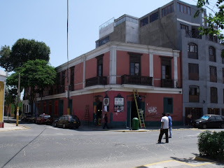
19.- Domeyer, Cavero & Junín streets, La Tapa Restaurant, La Posada del Ángel III bar, Domeyer hostel.

In the block between El Libertador street (which converts into Pedro de Osma street), Domeyer, Junín and Cavero streets, there are some houses with more than 100 years old. There we can find the restaurant La Tapa, the bar La Posada del Angel III, Domeyer hostel, among others.

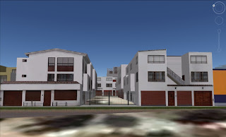
This model was very laborious because of the size of the block and because there’s a condominium in Junin street that increases the number of houses and facades, in addition to irregular and inaccurate terrain. For this model I used large number of poligons and 44 phototextures, despite which weighs just 544 kb.

La Tapa Restaurant, Domeyer & El Libertador street.
El Libertador street. La Posada del Angel III bar.
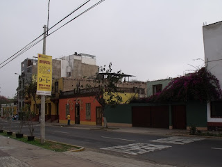
Domeyer street, Domeyer hostel.
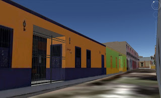
Junin Condominium
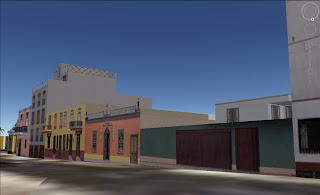
Aerial view from Cavero street and Junin street.